Geography — where Smøla lies
Smøla is a flat island in the Atlantic off Norway's west coast, between Kristiansund and Trondheim. The southernmost of the three large islands Hitra, Frøya and Smøla — at 274 km² one of the largest in Norway.
The island sits in the region of Møre og Romsdal. Smøla is exceptionally flat: its highest point reaches just 63 metres. This topography makes the island the ideal home for what was once Norway's largest onshore wind farm — and for long cycling trips along the coast.
Birds — sea eagles at the top
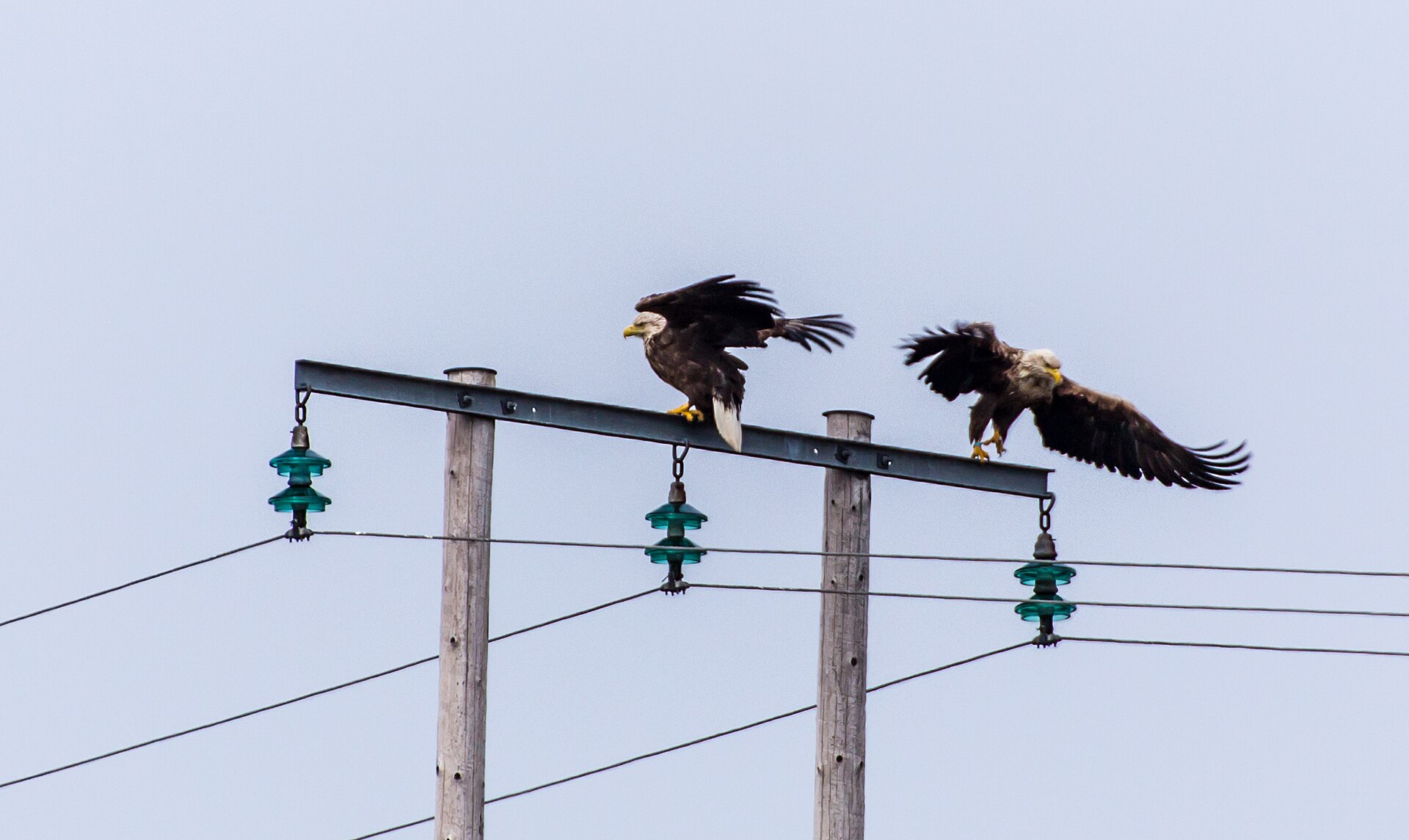
Smøla hosts the highest sea-eagle density in Europe. The white-tailed eagle, with a wingspan of up to 2.65 metres, breeds here in dozens of pairs on the skerries and steep coasts of the island.
Beyond the sea eagle, birdwatchers observe eider ducks, oystercatchers, loons, cormorants and puffins. The foundation "Smøla Naturopplevelser" offers guided sea-eagle safaris that we are happy to book for you.
Did you know? At the Smøla wind farm in 2020 it was scientifically demonstrated that painting a single rotor blade black reduces bird strikes by 70% — a finding now cited worldwide.
Veiholmen — the fishing village
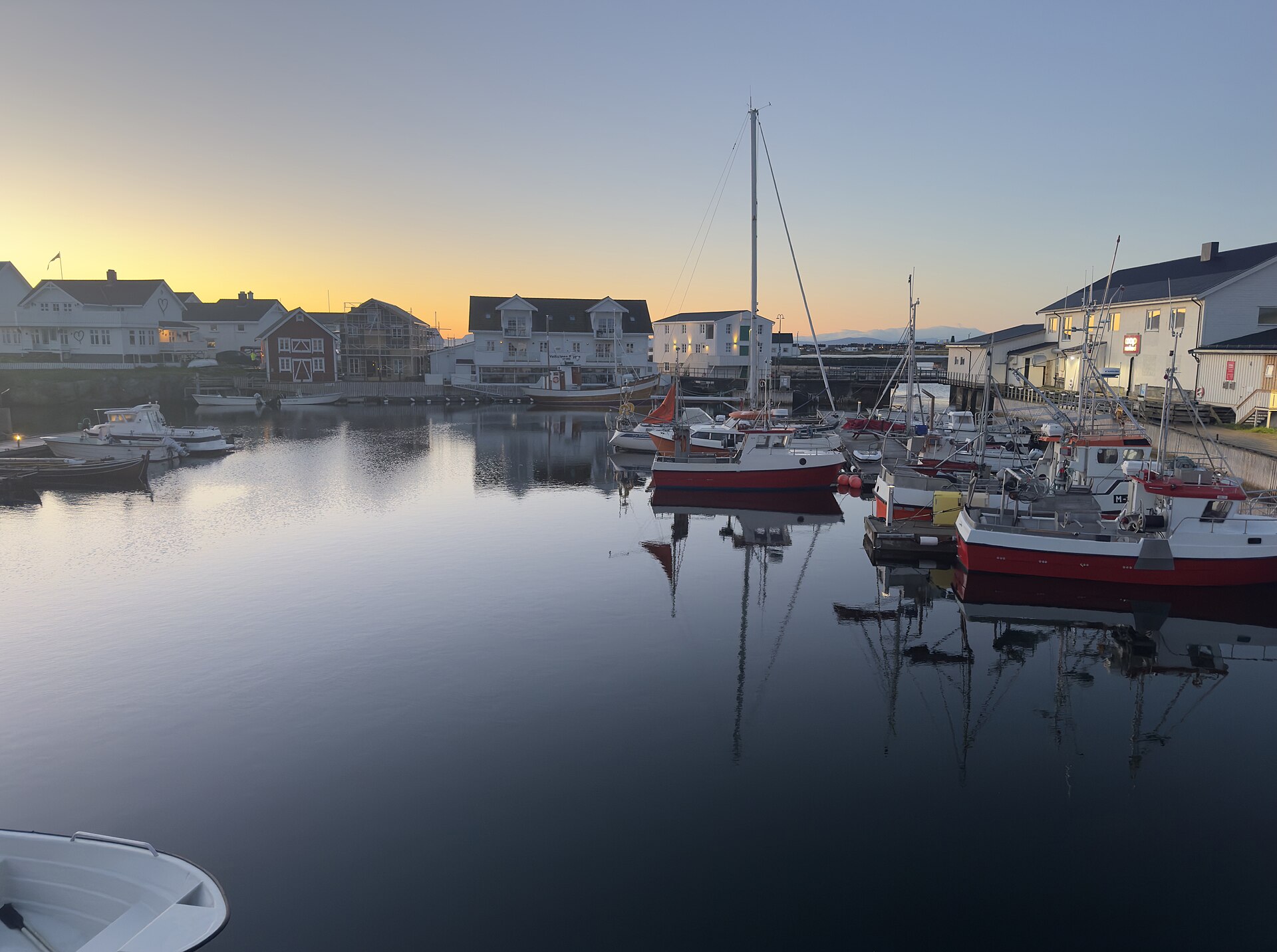
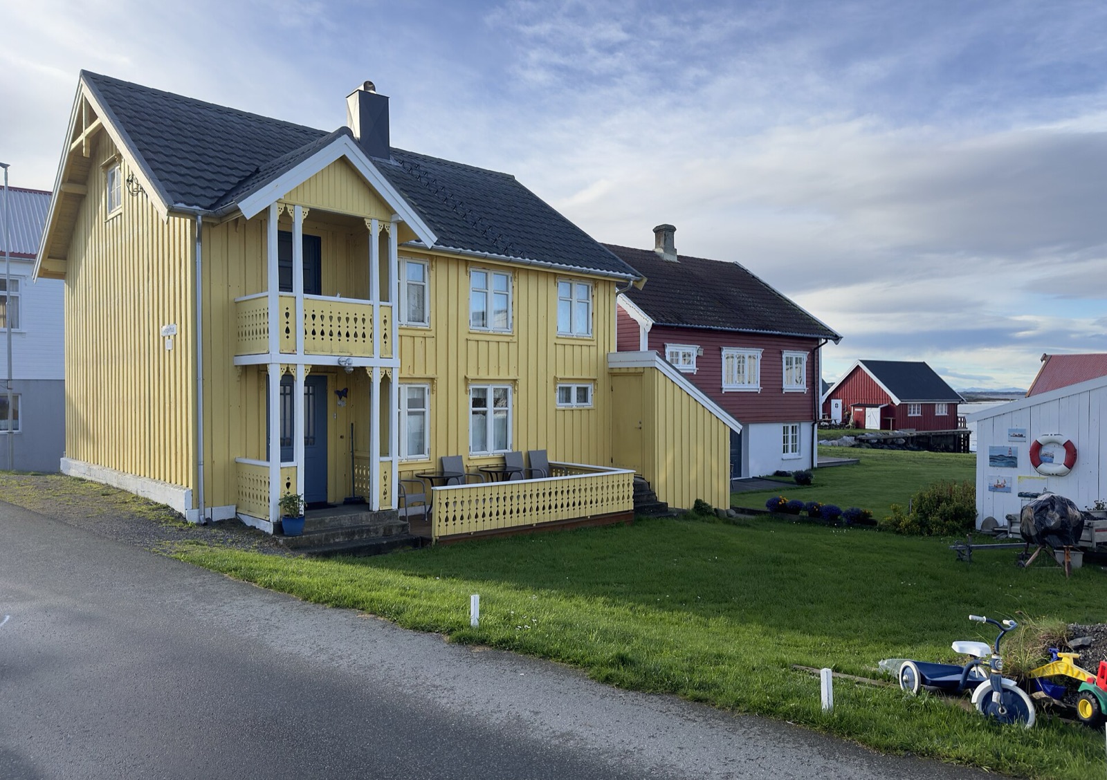
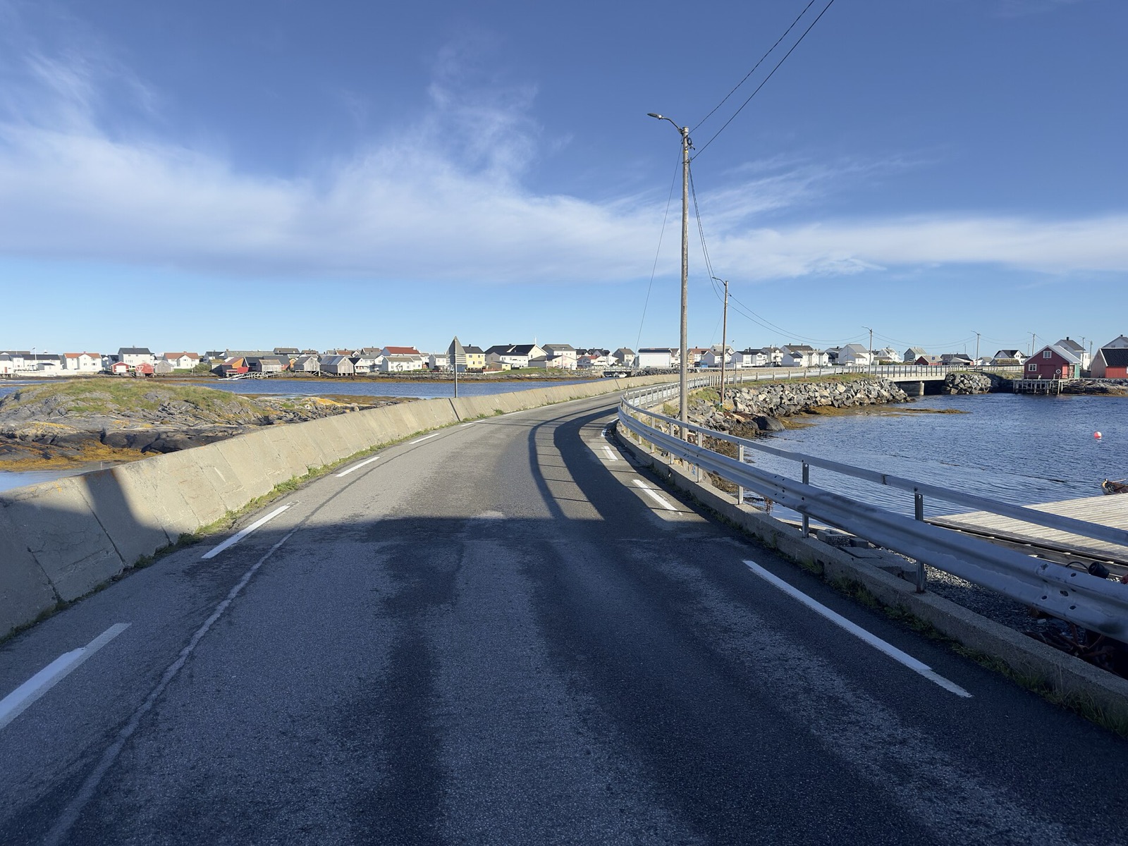
Veiholmen sits on a tiny group of islands north of the main island — connected by a road of bridges, causeways and breakwaters. Once the largest fishing village south of Lofoten, Veiholmen is today a lively village with active fishing, small cafés and the classic Norwegian coastal architecture.
Veiholmen is Smøla in miniature — once you've walked among the colourful wooden houses, you understand Atlantic life.
Skerries & Islands — the sea's second home
The coastline is framed by a wide skerry garden — more than 5,000 small and tiny islands. Vegetation shifts from west to east: the wind-blown west coast stays low, the east turns increasingly forested.
In summer the skerries can be explored by kayak, small boat or organised tours — many islets are uninhabited and reachable with a short hop.
Four seasons — four Smølas
Spring · May – June
First midnight sun from mid-May. Birds return to the skerries, water temperature slowly rises, the first fishing boats head out. A calm, clear pre-season before peak time.
Tip: May is the best time for birdwatching — all species breed in parallel.
Summer · June – August
Main fishing season: cod, halibut and pollock are in the main currents. 20 hours of daylight, warm days, mild nights. Best time for hiking, kayaking and skerry tours. Popular weeks are often booked months ahead — early booking pays off.
Tip: Mid-June to mid-July is "true" midnight sun — the sun never sets here.
Autumn · September – November
Northern lights season begins in mid-September as nights grow darker. Clearer views, calmer fishing (pollock shoals!), cool temperatures. For many regulars the most beautiful season — less bustle, deeper colours, often the first aurora sightings.
Tip: Travel around full moon for especially dramatic polar nights.
Winter · December – February
Stillness, long polar-night days, frequent aurora — for guests who seek the rugged, honest Norway. Shorter daylight (3–5 hours in December), mild temperatures thanks to the Gulf Stream (rarely below -5 °C).
Tip: On request we arrange snowshoe tours in the polar night.
Das Feriencenter ist von März bis Oktober geöffnet — Winter-Aufenthalte auf gesonderte Anfrage.
Activities in detail
Fishing
Smøla is one of Norway's finest sea-fishing grounds. Cod (torsk), pollock (sei) and pollack (lyr) run all year; in summer halibut (kveite), mackerel and coalfish move in. Fish the sheltered archipelago or the deep Trondheimsleia channel offshore. Our rental boats come with echo sounder, chart plotter and reserve tank — a filleting station and freezer for your catch are part of the centre.
Sea-Eagle Safari
A guided 2-hour boat tour with local wildlife guides from Smøla Naturopplevelser, starting at the Straumen guest harbour. Smøla has the densest sea-eagle population in the world — sightings are all but guaranteed in the May–September season. Family-friendly, suitable for children too. We coordinate the booking for our guests.
Kayak & Skerry Tours
Smøla Kajakk runs daily guided tours from Veiholmen from late June — three to four hours, paddling technique included, beginners welcome. Experienced paddlers rent kayaks and explore the 5,000 skerries on their own, often within touching distance of sea eagles and seals.
Hiking & Cycling
Smøla's flat topography — the highest point is just 63 metres — makes it an ideal cycling island. Marked coastal paths cross the Sør-Smøla landscape conservation area, over heath and moor to viewpoints like Rossvollhaugen (a 15-minute walk, with a shelter). Observation towers for the birdlife line the route along the wind farm.
Smøla Wind Farm
With 68 turbines, Smøla was once Norway's largest onshore wind farm. Marked paths and gravel tracks run right through it — an unusual cycle or hike across heath moor between the turbines, and at the same time one of the world's most important research sites for protecting birds around wind power.
Golf on the Atlantic
Smøla Golf Club (founded 2001) runs a 9-hole course on the western side of the island — one of the most north-westerly golf venues in Europe, set in heath and woodland terrain. Season May–October, visitors welcome.
Culture & Vikings
On the neighbouring island of Edøya, the Gurisenteret tells the story of the coast and the Vikings — with exhibitions, an escape room, a code trail and a treasure hunt for the whole family. Right next door stands the stone church Edøy gamle kirke from around 1190; in 2019 archaeologists used georadar to find a Viking ship more than 1,000 years old in the field beside it.
Weather & Climate
Smøla lies in the Gulf Stream — winters stay mild, summers cool. Wind is everywhere, but the rough climate is exactly what makes the island so clear and honest. The daylight swing is extreme: from around 20 hours in June to barely 5 hours in December.
| Month | Avg. temp. | Rain | Daylight / day |
|---|---|---|---|
| January | 1 °C | ○○○ | 6 h |
| February | 1 °C | ○○ | 9 h |
| March | 2 °C | ○○ | 12 h |
| April | 5 °C | ○ | 14 h |
| May | 8 °C | ○ | 17 h |
| June | 11 °C | ○ | 20 h (Midnight sun) |
| July | 14 °C | ○○ | 19 h |
| August | 14 °C | ○○ | 16 h |
| September | 11 °C | ○○○ | 13 h |
| October | 8 °C | ○○○ | 10 h |
| November | 5 °C | ○○○ | 7 h |
| December | 2 °C | ○○○ | 5 h |
○ wenig · ○○ mittel · ○○○ viel
Practical info on site
Mobile & Internet
4G/5G across the whole island via Telenor & Telia. Wi-Fi in every accommodation.
Shopping
Coop Extra and Joker supermarkets in Hopen (main village). Selection comparable to Germany.
Money
Card payment everywhere. Cash only at ATMs in Kristiansund (mainland) or Hopen.
Power
230 V, German plugs — no adapter needed.
Emergency
112 (police), 113 (ambulance), 110 (fire). Medical practice in Hopen.
Language
We speak German, Norwegian, English, Croatian. English will get you through everywhere on the island.